There are certain cultural, architectural, and geographic aspects you expect to see and experience when you visit Switzerland—things like fondue, chalet-style buildings, and glittering glacial lakes high up in the mountains. All three of those can be found in and around Andermatt—one of Travel + Leisure’s best places to travel in 2026—but there’s also one sight that’s a bit out of the ordinary.
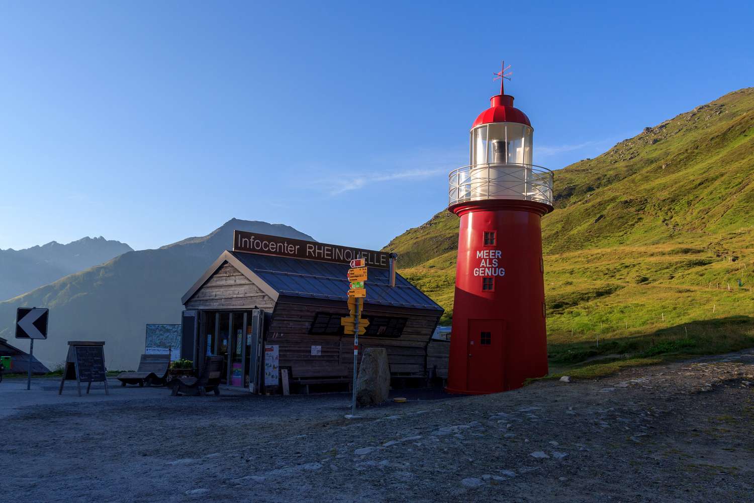
On a recent trip to the mountain village, I joined Tina Somers, the founder of Somers Salutations Yoga Studio & Retreats, on a journey up to the highest point of the Oberalp Pass. There, standing tall at 6,713 feet above sea level, sits the Rheinquelle Lighthouse. The red-and-white structure is known as the world’s highest-altitude lighthouse, with the Guinness World Record to prove it. Historically, lighthouses have served as navigational aids for boats. Not this one, located miles away from any open waters.
“The lighthouse symbolizes the source of the Rhine River. The actual source isn’t directly at the lighthouse, but just behind the ridge to the south lies Lake Toma. The lighthouse was built to mark the region where the Rhine originates and to make it accessible to everyone,” Bänz Simmen, a local guide and Andermatt native, tells T+L.
“Most of the locals see it first and foremost as a landmark—the top of the Oberalp Pass, one of the most important mountain passes near us. Here lies the official border between the cantons of Uri and Graubünden,” adds Somers. “It marks the starting point for many hikes in summer and ski tours in winter. And for many, it’s simply a great meeting point when you get lost on the slopes.” Whether you’re interested in hiking, skiing, or simply snapping a photo of this iconic landmark, here’s how to plan a trip to see the Rheinquelle Lighthouse.
How to Get There
KvdB50/Getty Images
There are a few different ways to get to the Rheinquelle Lighthouse from Andermatt—starting with the train. “The Matterhorn Gotthard Bahn offers one of the most beautiful train rides, running from Andermatt up to the Oberalp Pass and the lighthouse. It’s 35 minutes of jaw-dropping scenery and nonstop photo opportunities,” says Somers. Alternatively, you can choose to pair the adventure with a bit of exercise. “For the more adventurous among us, you can also take the gondola from Andermatt up to Gütsch and, from there, walk via the Lutersee to the lighthouse,” she says.
Of course, Andermatt is known among winter enthusiasts for its skiing, so the colder months open up a whole new way to experience the lighthouse. “In winter, the lighthouse lies at the heart of the Andermatt–Sedrun ski area. You can reach it by train, gondola, or ski lift, and it’s even possible to ski directly to the lighthouse,” says Simmen. Somers recommends rewarding the effort with dessert next door at Ustria Alpsu.
“This region also offers excellent ski touring, and in midwinter, you can often cross the frozen Lake Toma on skis,” says Simmen. “However, as in all alpine regions, avalanches are a serious risk. Always check local avalanche reports or hire a certified mountain guide, who can lead you safely through the most beautiful terrain.” Somers agrees, recommending the guides at Alpina Sport Andermatt and noting they “know the region inside out.”
Best Nearby Hikes
Roberto Moiola/Sysaworld/Getty Images
The lighthouse might make for good pictures, but there are plenty of more photogenic spots to be found via nearby hiking trails. “If you want to continue your trip a bit further to the real source of the Rhine, I recommend a beautiful summer hike up to Pazolastock, making your way to the Badushütte for a drink and a snack in a real mountain hut,” says Somers. “From there, continue down to Lake Toma—the view from this route is absolutely stunning. Then round off your tour back at the lighthouse to catch the train back to Andermatt.” You can also add on Rossbodenstock “as an extra peak,” she says, if you’re up for the challenge.
For those “with a good basic level of fitness,” she also suggests the hike from the lighthouse to the Maighelshütte. “It takes about 2 to 2.5 hours to reach the hut, where you can enjoy what might be the best rösti lunch of your life! You can return the same way, or—if you don’t want to miss Lake Toma and don’t mind some extra elevation gain—you can make your way to the lake and follow the higher trail back to the lighthouse,” she explains.
And if you’re prepared for a challenging, overnight backpacking trip? Consider the Vier-Quellen-Weg (Four Springs Trail). “This route starts at the lighthouse and leads all the way to the Rhone Glacier at the Furka Pass. It’s a five-day, hut-to-hut trek that takes you past the sources of the Rhine,” says Somers. “This trail is not for beginners—it involves significant elevation gain and covers 86 kilometers [about 53.5 miles] of mountain paths—but the stunning views make it all worthwhile.”
Know Before You Go
Lydia Mansel/Travel + Leisure
No matter when you go or what type of hike you choose to attempt, there are a few things to keep in mind when visiting the Rheinquelle Lighthouse and exploring the mountains surrounding Andermatt. “The lighthouse is located in a beautiful mountain landscape… However, don’t be mistaken: good basic fitness is required for all of these hikes. Make sure to bring a map, plenty of water, some food, and warm clothing,” says Somers. Simmen recommends wearing sturdy hiking boots and preparing for the “unpredictable” weather. “It can change from sunshine to snow within minutes, so always check the forecast before you go,” he says.
Read the full article here